

More of The Balkans

How many countries are in the Balkans? Does the boundary follow the rivers or the borders? I’m so confused.
The Balkan peninsula is a complicated area and so are its borders. At least the northern one. Most geographers agree that the border runs from the Black Sea along the Danube River to Belgrade in Serbia and from there along the river Sava to Slovenia. But then things get muddled. Some agree that the border runs from Sava along the Kolpa River, which represents the natural border between Slovenia and Croatia. But that means Slovenia is geographically completely cut off from the peninsula….? The other borders are not disputed and run along the coastline of the Adriatic (to the west), Black (to the east), Aegean and Ionian Sea (to the south). According to these borders we have seven Balkan countries that lie 100% within the peninsula, but when we count all the political and cultural factors, the number expands to ten, eleven or even twelve. Generally speaking, Albania, Bosnia and Herzegovina, Bulgaria, Croatia, Kosovo, Montenegro, North Macedonia, Romania, Serbia, and Slovenia are included. Portions of Greece and Turkey are also considered within the Balkan Peninsula.
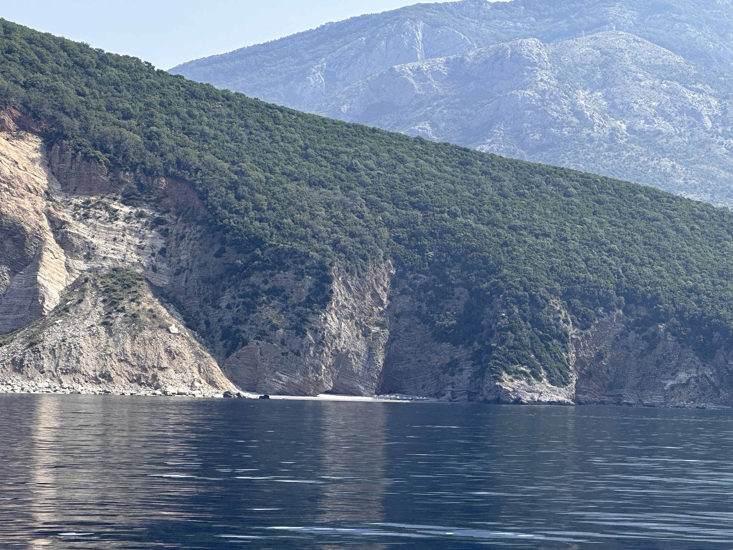
Zoom in - those are lounge chairs and umbrellas!!! Boat access only?
Montenegro is wild and beautiful. We had a gorgeous cruise up the coast from Albania and entered Montenegrin waters in just under 2 hours. The coastline looked rugged, mountainous and densely forested. The mountains average more than 7,000 feet (2,000 meters) in elevation. A couple of hours later we arrived in the southern most seaport of Bar. It was getting really hot and we’ve learned that clothing is optional while at sea. It took just 20 minutes to clear-in (fully clothed is best when dealing with foreign bureaucracies!) and then we rounded the corner and tied up at Marina - Bar. We were given a local map, information about where to find the supermarket, the telecom shops for a sim card and the best traditional Montenegrin food. The sim card was first on the list followed by a stop at very funky cafe/bar for (what else?) a hamburger and a beer! Damn that tasted good!


Montenegro is one of the smallest Balkan countries. It borders Croatia, Bosnia-Herzgovinia, Serbia, Kosovo, and Albania. It is well known as a part of the former federation of Yugoslavia. Nowadays, its constitution is democratic, environmental, and socially just. People were quite friendly and there seemed to be slightly more english spoken than we’d heard in awhile. We were thankful for this as Google Translate does not have Montenegrin! Oddly, Albanian is in Google Translate, but Montenegrin is not. While chatting with a sailor in Marina-Bar and lamenting our language woes, she casually mentioned that Serbian would work. Makes sense, the Montenegrin language has the same root as Serbian, Croatian, and Bosnian. Only very few differences in accent and expressions separate one from another. Friendly sailors and Serbian Google Translate for the win!

The next day we explored the town on our bicycles. We especially enjoyed people watching on the esplanade, seeing all the small venders with their handmade knives, fruits and vegetables, ice cream and toys. Eager to get out on anchor we didn’t spend too long in the marina. We stocked up at the “Voli Hypermarket” - the largest supermarket I’ve seen in all of the Balkans to-date!
After we left, I read that one of the world's oldest olive trees is located near the Old City in Bar. Scientific analysis of the wood tissue was carried out in 2015, which showed that the olive tree was 2240 years old! It has a diameter of 10 meters (nearly 33 feet) and is the oldest olive tree in Europe, and possibly in the world. That’s on the list for another visit.


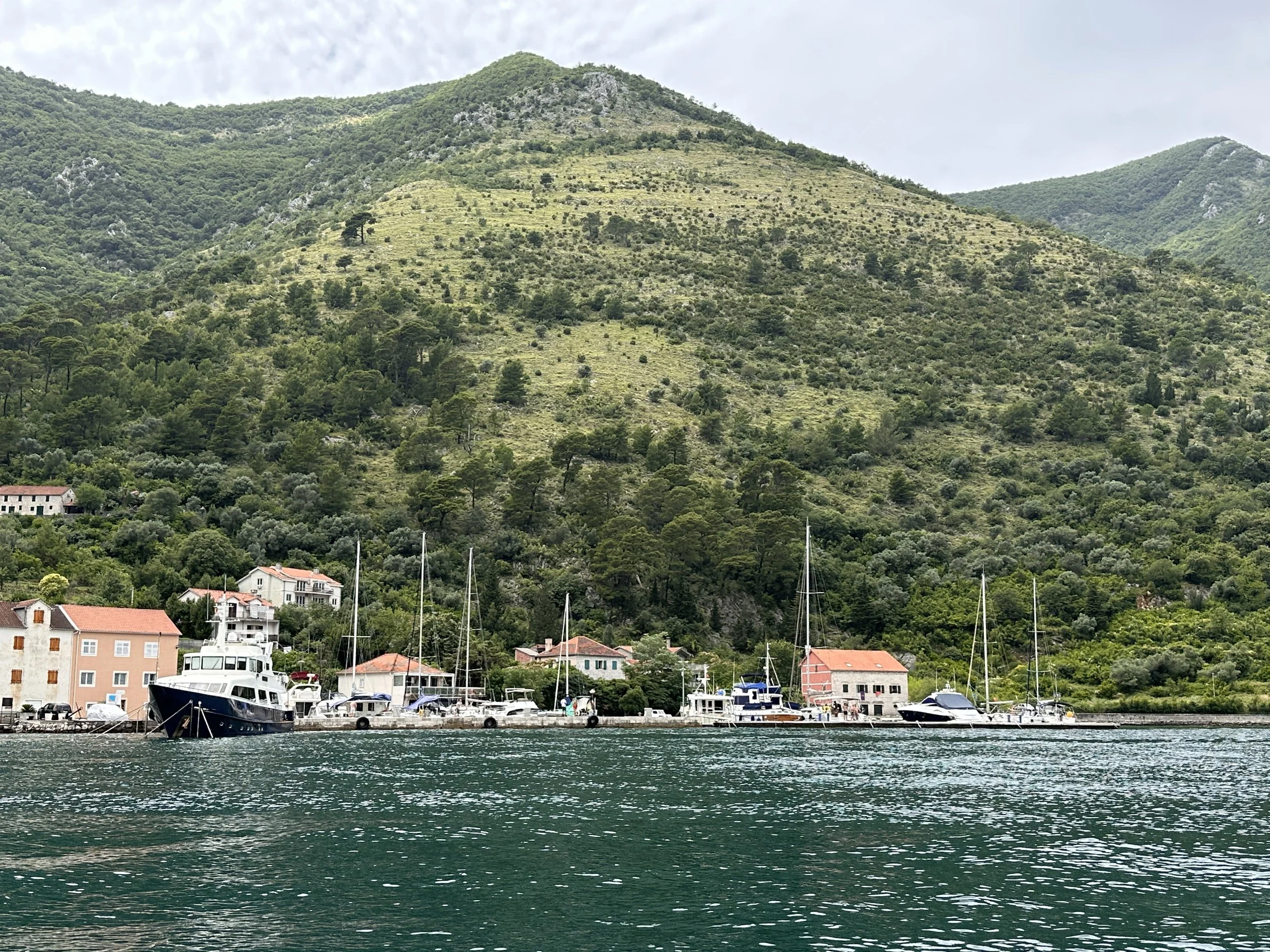
The next couple of nights were spent on anchor as we hopscotched our way up the short coast. We spent a couple of hours one morning cleaning Meraki’s hull but mostly we played on the paddle board and swam. Just a bit further and we entered the Bay of Kotor. This bay is Europe's southernmost fjord and is also one of the deepest natural harbors on the continent. It is listed as one of the 25 most beautiful bays in the world. I can see why!
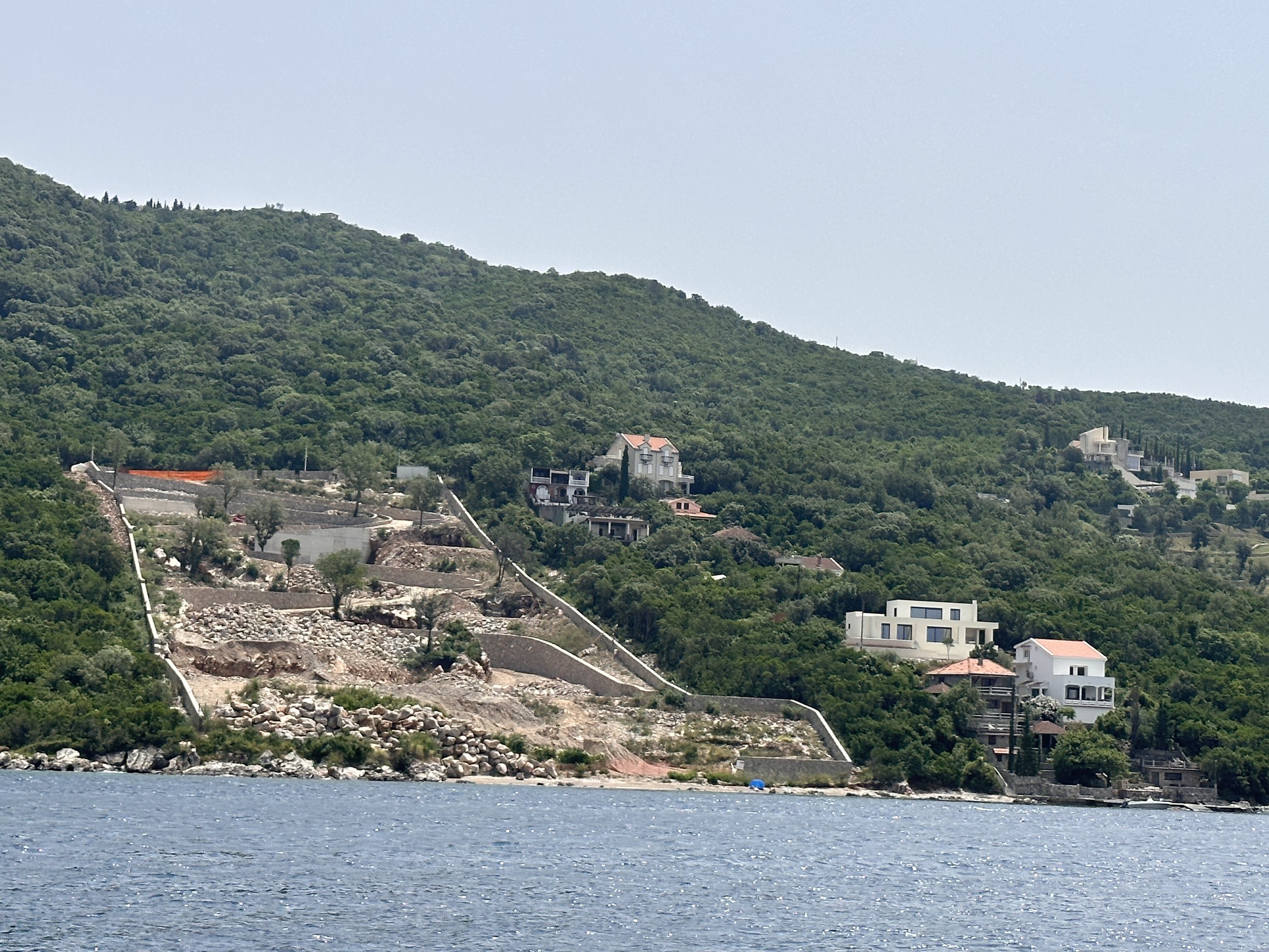
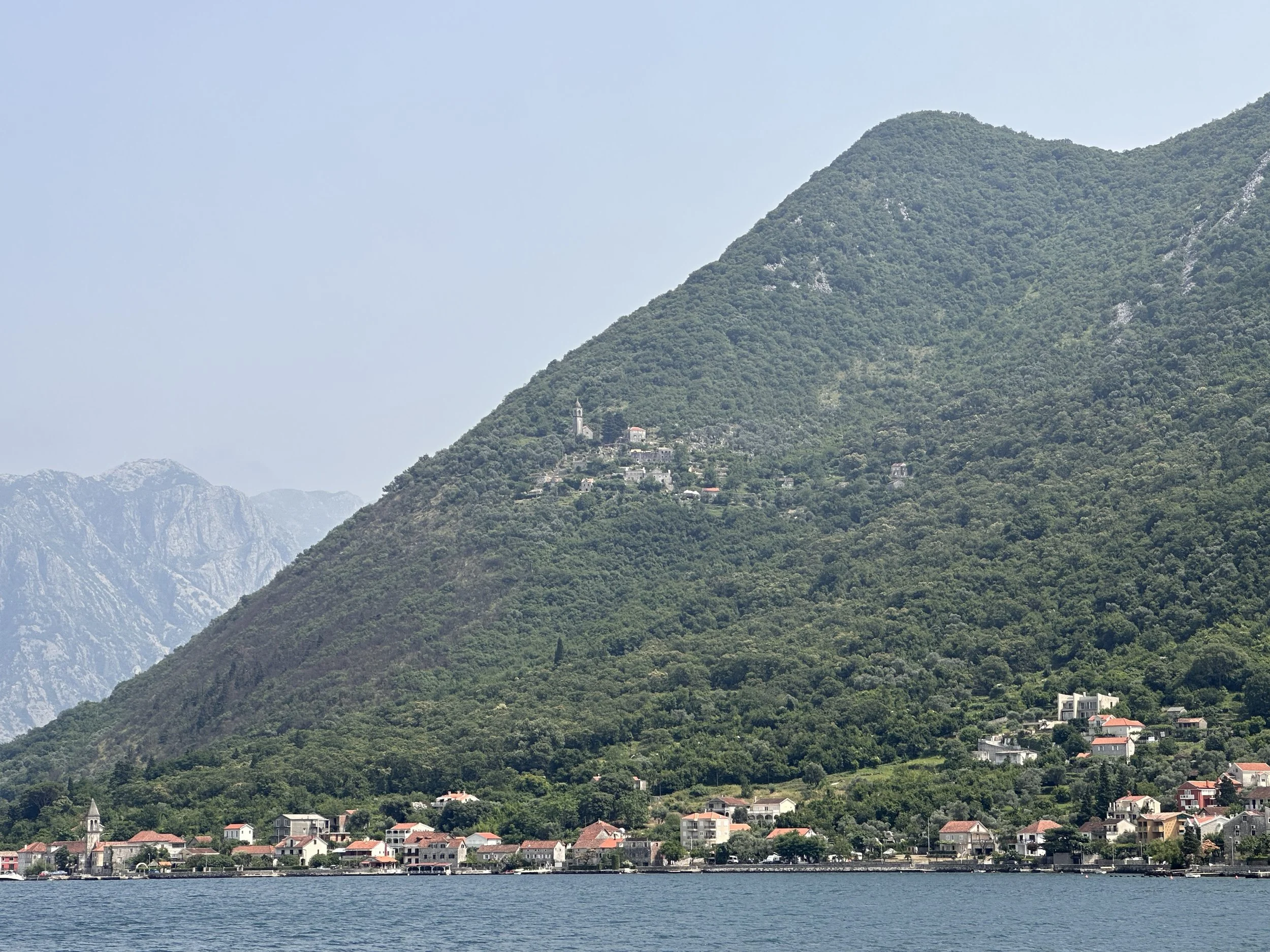
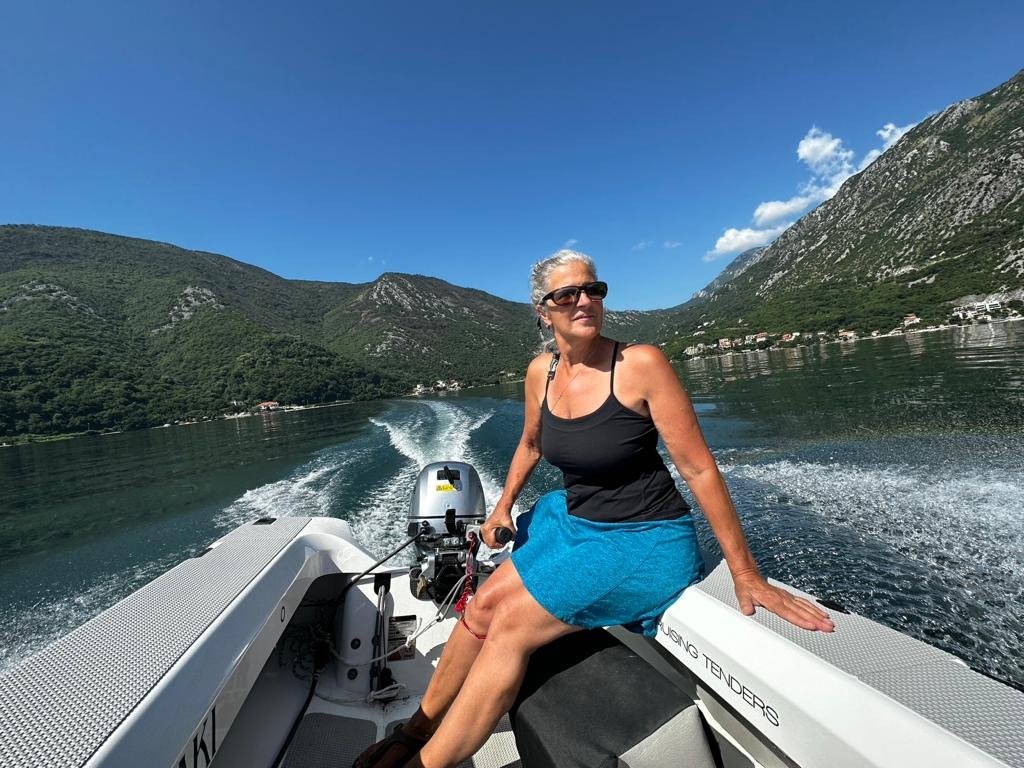
The bay runs deep into the mainland, twisting and turning between mountains hundreds of meters high, making it perfectly protected from the Bora (a strong, cold, katabatic wind common in the Adriatic). The water is perfectly calm deep inside the fjord. As the crow flies, it's only about 30 kilometers (18+ miles) long, but if you want to drive around it by road, it's over 100 kilometers (62+ miles). The mountains dive straight into the water and small settlements and villages cling to the flanks and narrow valleys. As we continued further, gliding around bends and meandering along its many folds, the landscape becomes increasingly spectacular. - the mountains get steeper, the scenery more rugged.


The kind marina matron gave us folding chairs to use while we waited (to no avail) at the bus stop.
We spent our first week in the teeny, tiny Prcanj Marina (pronounced Perch-in) with room for maybe 15 boats, run by a young woman. She was super kind, attentive to all our needs, told us some of the local legends, gave us a ride to the nearby city of Tivat one day when the bus didn’t arrive, and helped us purchase a boat stamp — something we’d never heard of before and discovered is necessary in Montenegro and apparently several other countries (?). We also met two ‘winter residents’ in the marina, one father/daughter from Taiwan and another couple from Poland with whom we swapped stories and traded banana bread for greek salad.
It was mid week and we’d spent the day working on boat chores, finished a late dinner on the back deck, and sat in the cool night air enjoying the evening. We did our evening boat check (lines, fenders, deck furniture, etc) and had just gotten into bed shortly before 11pm when I received a text from the marina lady. She said there was some wind and rain on the way and suggested we lift our passarelle a bit higher and pick up anything that might get blown around. We went out on deck to do one final check just as all hell broke loose! Winds from out of nowhere came raging across the bay. Everyone was instantly out on their boats buttoning things up and tying things down. The marina lady and her staff were there too and offered us an additional mooring line which we added it to our midships cleat. Even on the inside of the substantial breakwater Meraki was bouncing all over the place. The masts on the neighboring sailboats swayed into one another and the torrent of rain drenched our covered back deck. We stood, soaking, and watched in awe as the single-celled storm floated by overhead and just as quickly as it had surfaced - it was gone. The sudden silence was deafening. The excitement had passed, and we were thankful for the heads-up from the marina, the once-again tranquil sea, and our dry clothes. We returned to bed just after midnight and had a quiet nights sleep.


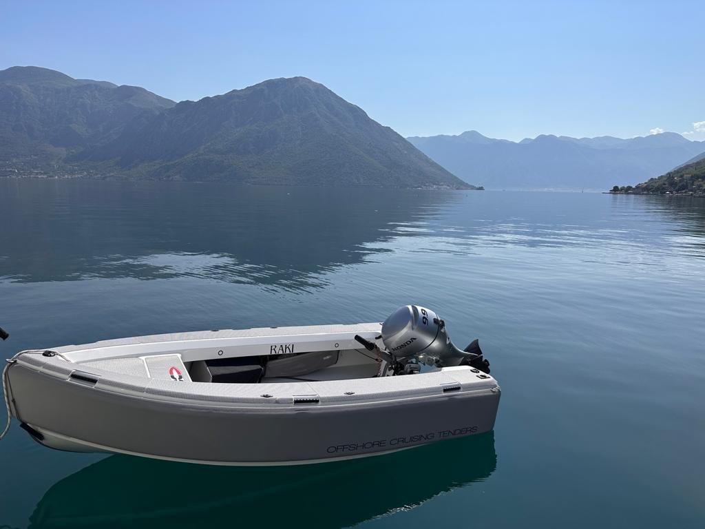
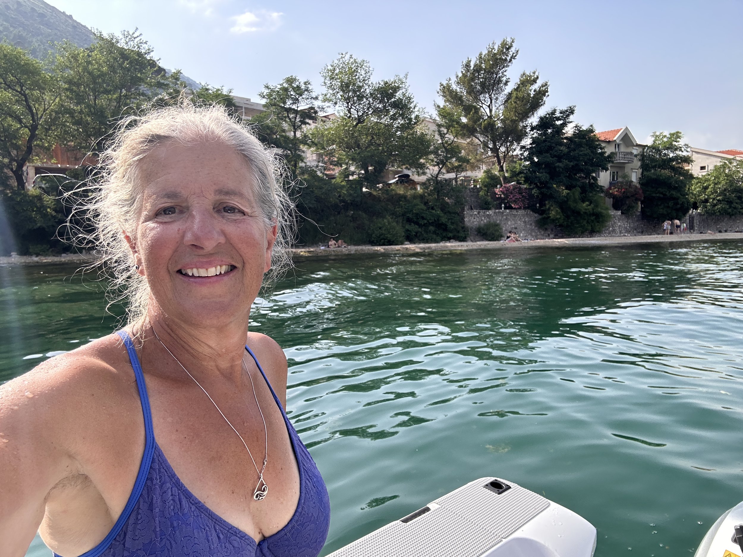
Most of the time the sea in the Bay of Kotor is waveless and generally flat as a pond. It was the perfect place for me to achieve the goal I’d set for myself this month - to become familiar, comfortable, and facile with operating our dinghy. We played with Raki almost daily. We dropped her tiny anchor near a beach, dove off and tried out her boarding ladder. We took her into town for groceries, for coffee, for lunch. She has become our little runabout and I love her!


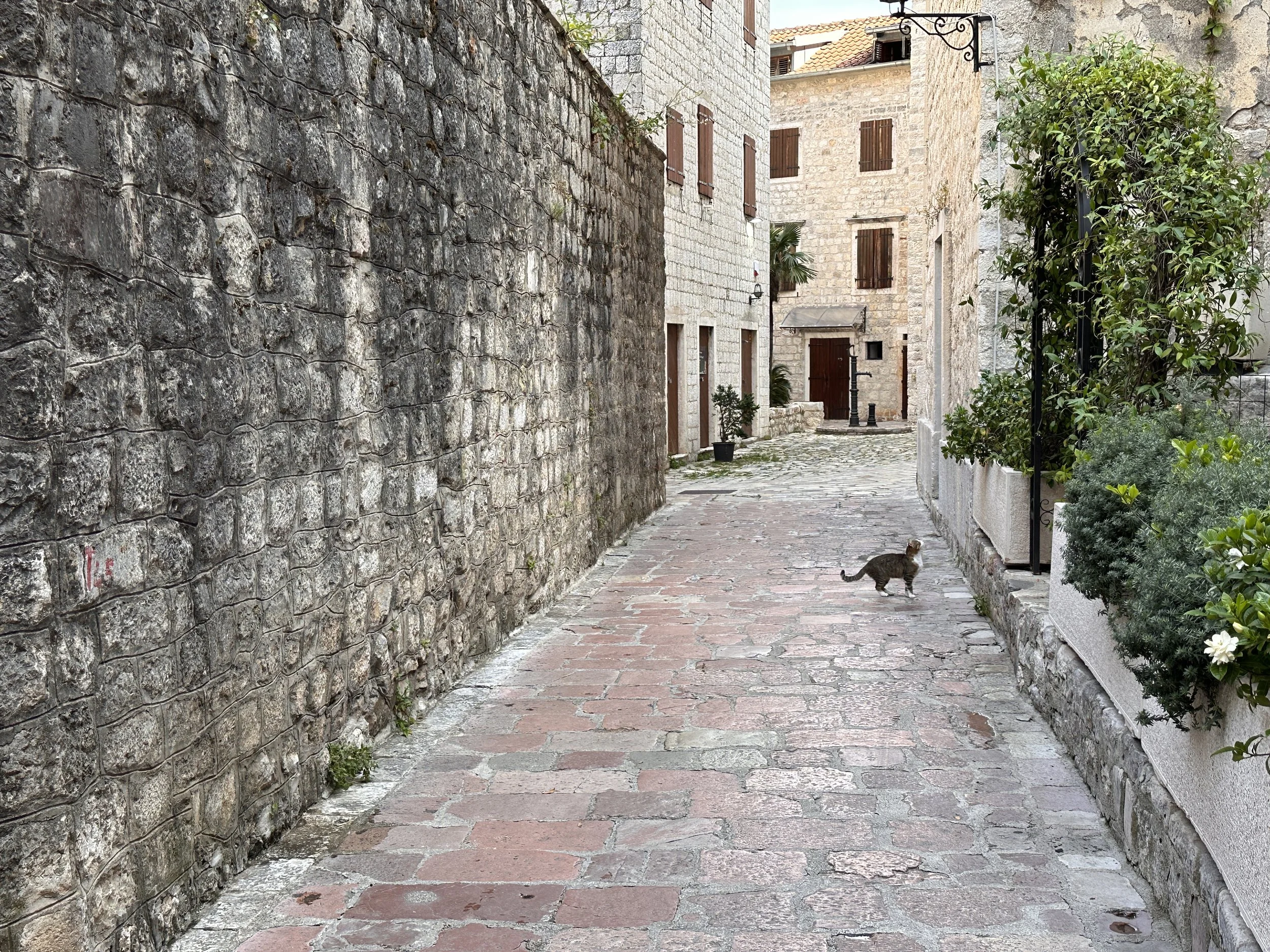
We got an early start one morning and set out in Raki to explore Kotor. The town is known as the black pearl of the Adriatic and is, without exaggeration, magnificent. Set at the foot of a sheer cliff, surrounded by rugged mountains and with the bay’s water lapping against its shores, it is a real gem of the Balkans. The Old Town is of cultural and historical significance and is a UNESCO World Heritage Site.
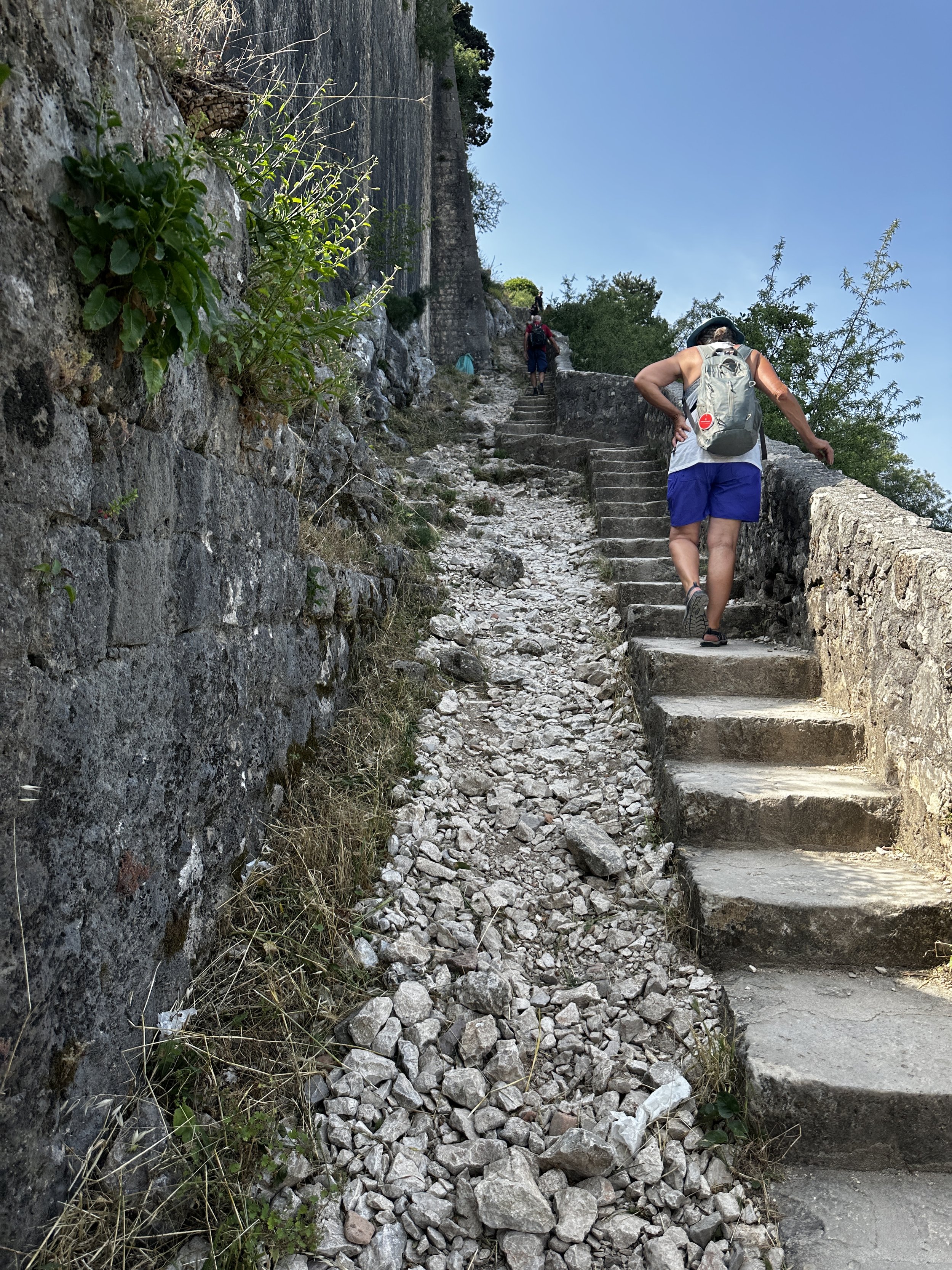
The Kotor Fortress stands on the San Giovanni Hill, 260 meters above sea level. It is part of a medieval fortification system that encircles the Old Town as well as the adjacent hillside. The fortifications consist of gates, bastions, towers, and ramparts. Starting in the Old Town, you climb the 1350 completely smooth, glossy, stone steps to the hilltop. The fortress has a long, turbulent, and complicated history, involving multiple occupations, sieges, earthquakes, and constructions. Suffice it to say it passed hands from the Illyrians, Romans, Serbians, Venetians, French, Russians and Austrians before it was liberated in 1944.
We started the hike just after 8am to avoid the heat and the crowds. It was hot. And it was crowded. But the views were out of this world - incredible awe-inspiring sights around every bend! It took us over an hour to make it to the top and we were exhausted. After a power bar and an extensive look around, we climbed down the same way we went up. Once back to the bottom we aimlessly wandered the cobbled street of Old Town. The walled city is a tangle of narrow passages lined with historic buildings which today house small hotels, humming restaurants and bars. It was fun getting lost in the maze. After a quick bite in a piazza in the center of it all, we exited the main gate and took Raki home for a much needed swim.


At the end of a wonderful week in a new favorite marina it was time to move onto anchor. But before slipping the lines we decided to splurge and we walked to a very classy restaurant in Prcanj village for an extraordinary meal! Montenegrin food is a special blend of East and West, Ottoman, Italian and Balkan flavors depending on where you are. It is rich with vegetables, good wine and aromatic herbs such as rosemary and oregano, and of course, is “ripened” in olive oil.


Like Albania, Montenegro was virtually unknown to me. Few places that I’ve seen are quite as impressive - it has thoroughly exceeded my expectations and captured my heart. Life is full and I’m ever so grateful.